All the way through southern Florida, where the houses and boats are SOOOO big, we somehow avoided being docked close to any that made Mary Frances look miniscule. Not so here. Oh well, the small cruise ships blocked the wind:
Wednesday we rode the marina courtesy van route to get an idea of what we wanted to do the next couple of days. Thursday we took a ride in the van to the Charleston Visitor Center and took a tour from there. Do you think this tour was advertised as a "mule-drawn" carriage? Just doesn't seem as romantic as horses, somehow.
The black disc is an "earthquake bolt", part of a brace installed to keep the building together after an earthquake in the 1880's. Many Charleston buildings have this extra decorative touch.
A few years ago we visited Charleston with Matthew and Christine. John and Matthew rode across the Ravenel Bridge between Mt. Pleasant and Charleston and back. Mary rode half-way. This time she was determined to make the complete trip:
The center span:
The WWII aircraft carrier Yorktown, which houses the Medal of Honor Museum:
We've traveled so far to come such a short distance!
We rode almost 14 miles. You may think we should discount the fast coast down the Mt. Pleasant side of the bridge, but riding back up that side, into the wind, more than makes up for the respite.
Charleston Coast Guard Station:
We left Charleston Saturday morning, April 28:
Houses along the Battery:
Looks like a long bike ride!
Castle Pinckney, part of the harbor defense system:
Fort Sumter:
The lighthouse on Sullivan's Island. Fort Moultrie, where Edgar Allen Poe was stationed, is also on this island, but on the ocean side.
Mary Frances IV posing as Towboat US:
We don't think these fishing boats are still in use:
Yes, that's really an alligator swimming across the river in front of us!
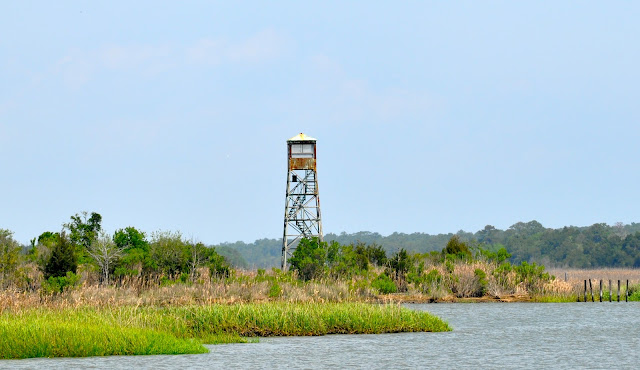
We saw couple of fire towers today and the 2012 edition of Tidelands, a Guide for Georgetown County, SC includes an article about these towers, used from the early 1900's until the early 1990's. Some are still in use as radio transmitter sites or repeater sites. The 911 system and aircraft replaced them to locate fires.
The intracoastal has changed and we see trees again!
This was an accidental picture, but we decided to put it in the blog to show what our electronic chart looks like. If John just keeps the little red boat on the magenta line, we are generally okay. Of course common sense, a good pair of binoculars, watching for markers that have been moved since the chart was published, e-mail updates, information from other cruisers, and good old-fashioned paper charts "just in case" are also important!
This cable-driven ferry is even smaller than the Ironton ferry back in Michigan:
Uh Oh-look how brown the water is. Will Mary Frances IV develop a mustache?
The walking tour brochure for this town is the best yet-they've put plaques on the houses with numbers that coincide with the numbers on the guide! Mary Frances at rest in Georgetown:


No comments:
Post a Comment